View of Olympic Range and Juan de Fuca Strait along Victoria's Dallas Road walkway. Photo © Stewart Butterfield via flickr and Creative Commons

View of Olympic Range and Juan de Fuca Strait along Victoria’s Dallas Road walkway. Photo © Stewart Butterfield via flickr and Creative Commons

The Coast Collective Arts Centre opened its summer show last week. Destination Victoria: Small Local Treasures features small works by Island artists and craftspeople. Each work celebrates the region, its land- and seascapes, and uniquely local experiences.

The show perfectly reflects the centre. Coast Collective resides in historic Pendray House on the shores of Esquimalt Lagoon, and combines a taste of the region’s history with a quietly spectacular setting. It is, itself, a local treasure. More »

Long Beach, Pacific Rim National Park. Photo © Kyla Duhamel, via creative commons and flickr

Long Beach, Pacific Rim National Park.

Nature Boy uses a number of smartphone apps with his work. Some help him identify birds. Others help him key out wild plants, fungi and other assorted roughage. He opens the astronomy app whenever he’s outside on clear nights. And because he works with people, he often photographs—with permission—families, school groups and kids Doing Cool Stuff Together in Nature, then immediately emails the pictures to the respective parents and teachers.

For somebody who interfaces so intensely with the natural world, he’s pretty hip to the latest gadget, gizmo and gew-gaw. His use of technology to augment his and others’ experience of the outdoors exemplifies some of the more positive, constructive aspects of being constantly connected. ]

Those integrated, positive interfaces came to mind when news broke earlier this year that Parks Canada proposed to provide WIFI access at busy areas of some national parks and historic sites over the next few years.

For example, with park WIFI access, I could double-check the tides before paddling around Gulf Islands National Park Reserve. I could check the day’s weather before setting out on the Long Beach Challenge, the 9.5-kilometre route that Pacific Rim National Park is marketing as the latest, greatest B.C. marathon-fitness trail. I could get Nature Boy to look up that weed while we stomp about Fort Rodd Hill.

Of course, with cell-phone coverage in this region, I could do most of that without park WIFI. At Fort Rodd Hill, I may even receive annoying text messages from the U.S. about cell-phone roaming charges.

However, my reaction to the news about Parks Canada joining the 21st Century may have been atypical….

Read the rest of this editorial at the Victoria Times Colonist….

Some friends organized a hike to Sugarloaf Mountain, near Sooke, this last weekend.

Clear in East Sooke Park; Cloudy at Rocky Point

Clear in East Sooke Park; Cloudy at Rocky Point. We were serenaded by the Race Rocks foghorn while we hiked.

A tugboat and logboom emerge from the fog, East Sooke Park, March 29 2013

A tugboat and logboom emerge from the fog bank over Juan de Fuca strait.

Fog rolling in. East Sooke Park, March 29 2013

Parasol: Beechey Head.

The fog closed in at Beechey Head. East Sooke Park, March 29 2013

The weather followed us. And, as we sat there, becoming enshrouded, the Race Rocks foghorn stopped its serenade. Foggy on Beechey Head; Clear at Rocky Point. :(

Fog landwards from Beechey Head. East Sooke Park, March 29 2013

The fog cleared inland. East Sooke Park, March 29 2013

Clear inland. As we walked back to the car, we left the fog behind.

Bloomin' skunk cabbage: Smelly signs of spring in B.C.'s forests

Bloomin’ skunk cabbage: Smelly signs of spring in B.C.’s forests

Kananaskis Country in winter. Photo by Brian Uhreen, http://www.flickr.com/photos/snype451/5644810651/

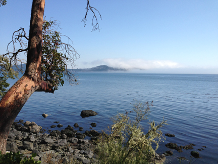
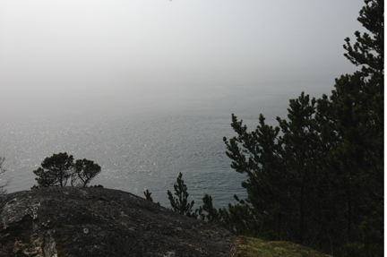
Although weather in Alberta’s mountains can be counted on to be unpredictable, when it’s sunny, it’s glorious. Photo by Brian Uhreen

Explore Kananaskis, Winter/Spring 1997Covering more than 5,000 square kilometres, Alberta’s Kananaskis Country encompasses everything from foothills in the east to the rock, alpine Continental Divide in the west, from the wide, windswept Bow River Valley in the north to narrow passes and valleys in the south.

With such variety in terrain, elevation and exposure, one of the few things you can count on regarding weather in the wilderness region is that is it unpredictable. The adage, “If you don’t like the weather, wait five minutes,” applies.

Winter – generally

Winter in Kananaskis starts in November and lasts until March. Unless it starts in September. Or ends in May. There are years when an early drop in seasonal temperatures lowers the snow line soon after Labour Day. There are as many years when winter blasts on and on until June, at which time summer arrives, bypassing spring altogether.

Duelling weather systems

Kananaskis Country generally has two continental weather systems in play during winter. Frigid, dry Arctic systems from north or east blow without resistance over the prairie until they smack into the Rocky Mountains. These ramparts of stone funnel and deflect the air-flow southward. The arrival of these systems usually means cold temperatures and ice crystals in the air. These systems can also dump snow in the foothills while bypassing points further west.

Contrast that with the Pacific weather that blows in from the west coast. These systems tend to be warmer than Arctic systems, and are laden with moisture that falls as rain in Vancouver and turns to snow as they are forced up the staircase of mountain ranges across British Columbia. By the time the systems arrive at Alberta’s western reaches, the majority of the moisture has already condensed into clouds and precipitated out on the western side of the Continental Divide.

The amount of snow lessens the further east a wintertime Pacific system extends. Thus, West Bragg Creek, on Kananaskis Country’s east side, receives less snow from these systems than does Peter Lougheed Provincial Park, abutting the Continental Divide to the west.

Elevation effects

Cross-country skiing, in Kananaskis Country. Adam Kahtava photo - http://www.flickr.com/photos/kahtava/5213943879/

Kananaskis Country is home to some of the best cross-country skiing in Canada. Photo by Adam Kahtava.

Elevation influences the differences in snowfall and accumulation between east and west Kananaskis Country. The higher you go, the colder it gets, the more likely that what precipitation there is will fall as snow, not rain. Snow accumulates; rain does not.

However, to every rule, there is an exception. Although higher elevations usually do mean lower temperatures, diehard winter outdoor enthusiasts have been known to leave Calgary where it is –35° C and spend a sunny day on Peter Lougheed Provincial Park trails in balmy –10° C temperatures. This winter phenomenon is called temperature inversion, and occurs frequently in this part of the world. Arctic high-pressure systems spread a thin layer of cold, murky and sometimes polluted air over the prairies and foothills valleys. One of the warmer western systems—as much as 15° C warmer—sits above it, trapping the cold air below.

To find out when to take advantage of a temperature inversion, compare Environment Canada’s Calgary forecast to its Banff forecast. If it’s warmer in Banff, temperature inversion is occurring.


Chinooks: spring in February

Chinook Arch at Sunset. Photo by Tuchodi, http://www.flickr.com/photos/tuchodi/5381184500/

Chinook Arch at Sunset. Photo by Tuchodi

East–west differences in snow accumulation can also be affected by recurring Chinook winds. Chinooks are a distinctive part of the Pacific weather system: as many as 10 times each winter, they blow in from the west, gradually chilling and dumping snow as they climb the British Columbia mountain staircase. With one final dump on the Continental Divide, a now-near-dry Chinook wind flows down the mountains to the plains, skipping over the Rocky Mountain front ranges and foothills like a rock skipping over water. As the wind descends, its temperatures rise faster than they had cooled on the ascent. Somewhere over the eastern edge of the front ranges, the Chinook encounters a very cold, Arctic high-pressure system locking the prairies in its frigid grip. What moisture remains in the Pacific systems condenses, forming a distinct arch of cloud along the line of the mountains.

The Chinook Arch announces a dramatic reprieve from winter. Temperatures can rocket from –30° C to +10° C in a matter of hours. Snow vanishes. Gutters fill. Spirits rise. Calgarians go home in the shirtsleeves, lugging parkas in their arms. Elk and deer, and antelope on the prairies further east, can feed and move about easily again.

Points west in Kananaskis Country tend to be frequently skipped over by Chinooks. Although these winds do occur in Peter Lougheed Park and the Spray River Valley, they tend to be weaker and more ephemeral there. The Bow River Valley sees the most Chinooks of all of Kananaskis, often serving to funnel them east out of the mountains and onto the plains.


It can be difficult to find fresh herbs for sale in the supermarket and even the markets. In the south of France, flavourings in the regional cuisine is defined by the herbs that grow wild and free in the fields and wild lands: thyme, rosemary, savoury, bay, even lavender.

So although there is demand for these herbs, if you can forage these ingredients for free, or can effortlessly grow them outside your kitchen door, why would you pay for them?

Bay (laurel)

Last visit, I resorted to harvesting a handful of bay leaves from bushes growing in the precinct gardens of the abbay at Caunes-Minervois, and parsimoniously eked out their use through the following weeks.

L'Abbaye de Caunes Minervois

The cloisters at l’abbaye de Caunes Minervois

Behind the abbaye, with bay laurel growing in the precinct

Behind the abbaye, with bay laurel growing in the precinct


This visit, I noticed—a sign perhaps of my improving mental health—a massive bay hedge across from the Mairie in Belloc. Right next to the bottle and paper recycling bins. And it’s not as if we didn’t have reason or opportunity to notice said hedge when we were unloading our glass-ware and paper last time around…. However, there we are: a boundless source of fresh bay, of which I availed myself a number of times for the purposes of making soups and other savoury dishes.

Oregano (0rigan)

This herb grows wild on the approach to, and within the confines of, the ruins of Roquefixade fortress. Culling the herb was a reason to stop and catch my breath on the way up.

Fennel (fenouilh)

The Aude Departement of France has many towns named for this aromatic herb. I found fennel going to seed along hiking trails leading out of the village of Hounoux in the Razès region and along a seldom-used road west of Fanjeaux.

Rosemary (romarin)

I didn’t need to forage for this herb, as there is a pot of it growing on the terrace in front of the house we are renting. However, I did find it growing wild on the hillsides west of Fanjeaux.

Fanjeaux barely visible on the hilltop

Fanjeaux barely visible on the hilltop

Thyme (thym)

Wild thyme is stronger and more distinctively flavourful than domesticated thyme, and is a key addition to herbes de Provence. Even though the Aude and Ariège regions are hundreds of kilometres from Provence, and lack the “garrigue” or limestone-hilltop scrubland that Provence is known for, the Aude does have terrains de genêts: similar, and similarly aromatic, scrubland.  This herb grows in great perfumed profusion along the westerly Crêtes d’Hounoux (Hounoux ridges) hiking trail, and the most-western slopes of the Boucle de la Hille (La Hille circle) trail out of Fanjeaux.

Savoury (sarriette)

My will broke when I saw live savoury plants for sale at the Esperaza market. With Victoria’s cool summer nights and the multitude of insect pests that the area’s mild winters don’t kill, I haven’t been able to grow savoury since I left Drumheller.

I bought a plant and inserted it into one of the planters at Mirepoix. Now that autumn has arrived—bringing intermittent rainy days—it might even survive until next summer. Regardless, I tipped the branches and was able to season my sauces with the leaves from this particular plant throughout September.

Chateau Aguilar

Aguilar chateau

One of the “National Monument” ruined Cathar castles in the Aude.

Aguilar chateau

Looking down on the vineyards below chateau Aguilar.

Chateau Roquefixade

Gaston and I caught the Friday market in Foix, took a heap of photos as the light was crystal clear—that would have been the first day of Autumn light—then departed to conquer Roquefixade.

We’d been intimidated by this chateau on previous visits. The approach appears vertiginous.

The pog of Chateau Roquefixade

Chateau Roquefixade: the wee red flag at the top of the peak marks the ruins of this Cathar stronghold.

First visit to the area, which encompassed only six days, we gazed at it from Montségur and noted the cathar-cross flag flying at the top of the peak. On visit #2, we explored the town at the base of the cliff, climbed to the rock face, then decided, “Another day.” I believe a mild case of food poisoning or airplane stomach-bug played a role in that choice.

Even this time ’round, as we drove towards it from the west and saw how steep the outcrop on which the ruins are perched, Gaston and I were each dreading the endeavour. But, of course, we didn’t say anything. Which I think is mighty big of Gaston, who has confessed to me that, actually, he really doesn’t care for hiking, and especially doesn’t care for hiking up steep inclines, especially when it is warm out.

Does this mean he was humouring me? Who cares!

It turns out the hike to the chateau is deceptive: it isn’t nearly as rigorous as it appears from up the valley or from the village.

Roquefixade village

At the base of the village, overlooking the valley to the southwest, was a small “villa” (modern house) with a million-dollar view and cracks so large in the walls, you can see into the interior. Said house is for sale “on condition of unbuilding.” The edge of the hill beneath the house is subsiding. What a heartbreak for the owner who invested.

Don’t believe me? The trail winds around the base of the rock to the back side of the pog, then ascends at fairly reasonable, albeit still steepish, incline to the back of the fortress.

And we saw our first Griffin vulture whilst lounging at the top: a freaking HUGE, black bird that was riding the thermals off the crest.