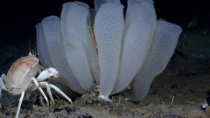
Glass sponge. Photo © NOAA

More than 500 species of glass sponge exist. Only some of them have the fused-glass skeletons that lead to the creation of reefs such as those found off B.C.’s coast. Photo: NOAA Okeanos Explorer Program, Gulf of Mexico 2012 Expedition

In recent decades, species of sponges thought to have gone extinct 100 million years ago have been found in B.C.’s coastal waters. They not only make these waters home, but they make homes for themselves and many other creatures.

Now the federal government is moving to safeguard these rare organisms and the unique underwater ecosystems they have created. In early June, Fisheries and Oceans Canada closed B.C’s glass-sponge reefs to all fishing.

In addition, proposed, new marine protected areas will prohibit all seafloor-disturbing activities on and immediately around three glass-sponge reefs in Hecate Strait and Queen Charlotte Sound.  The protection focuses on the reefs and small buffer zones, with various activities allowed beyond and in the water column above….

Read the rest of this editorial at the Victoria Times Colonist….

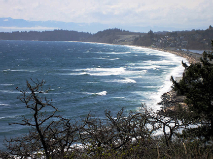
Royal Roads shoreline outside Esquimalt Lagoon. Photo © David Stanley via flickr and Creative Commons. www.southpacific.org

The year has begun amidst a series of earth-shaking events.

Three earthquakes were reported for the Vancouver Island region on January 2. The biggest, at magnitude 5.4, occurred 211 kilometres west of Port Hardy, while two smaller tremblers occurred west of Port Alberni. Five days later, a 4.8-magnitude quake west of Port Alice shook the coast.

They form part of a regional swarm of earthquakes that began late last year, as the tectonic plates beneath Vancouver Island released rock-bending pressure. To add perspective, about 4,000 earthquakes occur in B.C. every year. Of these, only a few—like the larger January quakes—are felt by people.

As solid as the ground beneath our feet seems, when the forces that shape the our planet’s surface start squeezing it, the granites, basalts and sedimentary rock on which our region’s municipalities are built take on the consistency and strength of something like fine, aged Cheddar….


Read the rest of this editorial at the Victoria Times Colonist….

Water stored in the St. Mary’s Reservoir, north of Cardston, Alberta, insures area farmer’s crops against drought, which is common in that part of the province. In 1998, when the reservoir was drained to build a new spillway, researchers discovered tools used by ancient Albertans, as well as bones and footprints of at least 20 species of long-extinct animals.

“If you had stood there 11,000 years ago, you could have seen mammoths, horses, camel, caribou, bison, wolves, ground squirrels, and birds—maybe all at once,” says Len Hills, professor emeritus of geology and geophysics at the University of Calgary, and one of the scientists studying the site. Joining him in the research are university archaeologist Brian Kooyman and students Paul McNeil and Shayne Tolman, the site’s discoverer. “We know from the way the trackways are intermingled that these animals were right there, together. And man was there, too—he was part of that environment.”

The site is a window on the end of the Ice Age in southern Alberta. By inventorying the animals that lives in the region and studying the role of early humans at the site, Hills and colleagues reconstruct the ancient environment.

About 12,000 years ago, the site was an island delta at the end of a glacier-fed lake. When the St. Mary’s River later drained the lake, it created a massive floodplain west of the island Within a period of days or maybe weeks, large numbers of diverse animals visited the area to feed on the delta’s lush vegetation and drink from the nearby river, trampling the gound with their hooves and feet. Thick layers of sand and dirt blew eastward from the floodplain to bury tracks, bones, and tools. A series of brief geological moments were preserved, recording the presence of animals and humans over a 300-year period about 11,000 years ago.

The oldest tools are Clovis points, flaked-stone implements used by the first North Americans. Not far from where the team was excavating the skeleton of a horse, the researchers found toold that may have been used to kill the animal. Laboratory tests reveal traces of ancient horse protein on two of the Clovis points.

“We’ve known from other sites in North America that they hunted mammoths,” says Hills. “But this is the first sold evidence that Clovis people actually hunted horses. Maybe early humans influenced the extinction of these animals—not just mammoths, but horses, too.”

What precisely caused the disappearance of so many Ice Age mammals 12,000 to 9,000 years ago is uncertain. Climates and environments were changing rapidly as the glacier receded from the continent. Those changes alone would stress animal populations. New species from Asia may have increased competition for food, or may have introduced diseases. Humans may have been another factor in the ecological reorganization.

When McNeil inventoried and analyzed the fossil trackways, comparing information about movement and size of the ancient animals with data from tracks made by modern elephant herds, he found some evidence that the herds visiting the reservoir site 11,000 years ago were stressed.
“The ratio of young animals to adults was far below what we would consider healthy levels in modern populations of similar animals,” he says. “This site captures this one brief moment in time and tells us something was definitely happening.”

The magnitude of the site is the way that it is letting us see how these animals interacted with their environment, with each other, and with early humans.

excerpted from: Reading the Rocks: A Biography of Ancient Alberta
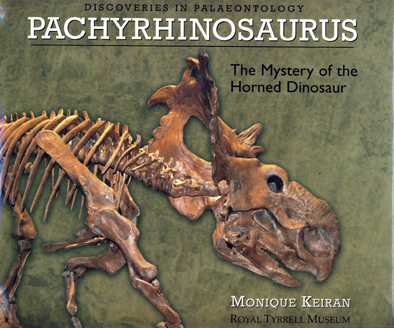
cover-pachyrhinosaurus-by-monique-keiran

book-ornithomimus-by-monique-keiran

Sample pages from Ornithomimus: Pursuing the Bird-Mimic Dinosaur, by Monique Keiran. Published by the Royal Tyrrell Museum of Palaeontology and Raincoast Books, 2002.

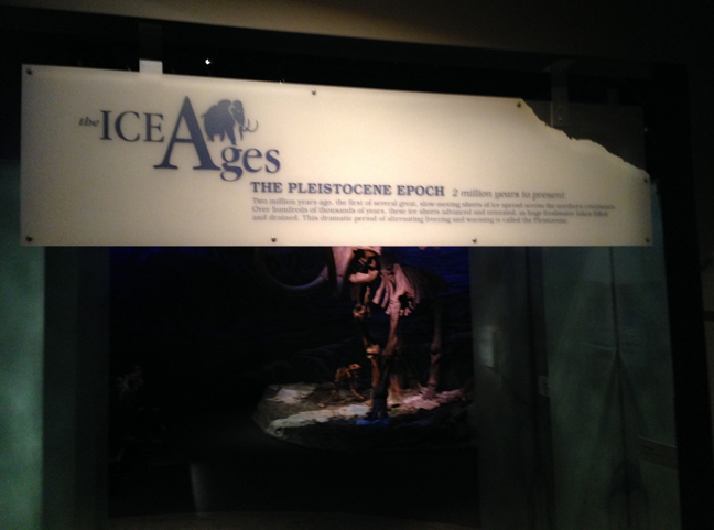
The Ice Ages Gallery

The Pleistocene Epoch
2 million years to present, at the Royal Tyrrell Museum of Palaeontology, Drumheller, Alberta

The Royal Tyrrell Museum opened the Ice Ages Gallery in 1999. A collaboration between curators, technical staff, the exhibits team and others, it tells the story of Alberta from two million years ago to the present—the time called the Pleistocene, when huge mammals roamed, great ice sheets came and went, and humans first arrived in North America.

I prepared the text for the panels and labels. Browse through the image gallery below for a view of gallery displays and signage. To read the signage, click on the image.

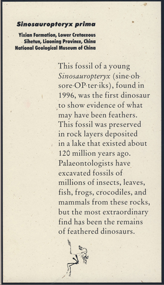
Compare these two interpretive display signs.

Staff at the Yale Peabody Museum wrote this sign for its traveling exhibit, China's Feathered Dinosaurs.

Staff at the Yale Peabody Museum wrote this sign for its traveling exhibit.

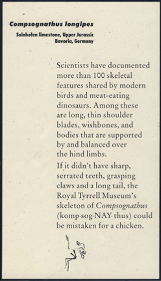
Monique Keiran wrote text for this sign for a Royal Tyrrell Museum specimen supplementing the Yale Peabody exhibit.

Monique Keiran wrote text for this sign for a Royal Tyrrell Museum display supplementing the licensed exhibit.


The license for the Yale Peabody Museum’s China’s Feathered Dinosaurs exhibit allowed host museums to add to the displays, but forbade them from changing any material provided by the Yale Peabody.

The Royal Tyrrell Museum faced a challenge: How to seamlessly fit its own specimens and interpretive panels and signs into the existing exhibit.

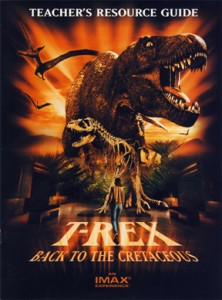
Trex teacher's resource guideIn 1998, IMAX Corporation and the Royal Tyrrell Museum of Palaeontology joined forces. IMAX filmed its first fictional IMAX film at the museum—and it was about dinosaurs. Of course.

One of the collateral projects that accompanied the film was a teacher’s resource guide. I worked with Sue Mander, from IMAX, and the Tyrrell’s education staff and researchers to produce text and activities for the guide.

Click T.rex: Back to the Cretaceous teacher’s resource guide to access a PDF that samples the guide.

Warning: this is a large file, and will take time to load.