An elderly woman was found dead and three people sick with flu-like illness were taken off a Vancouver-Toronto train in Parry Sound, Ont., on Dec. 29. This incident demonstrates how serious infections like influenza can be.

Before the holidays, we heard flu season started early this year. And with people travelling for the holidays, officials warned the virus might spread as people met over turkey and under mistletoe.

Read more….

bald eagle, by Mark Stephenson

Victoria Times Colonist, December 8, 2012—We’re in Courtenay at the end of this year’s salmon run. We’ve already seen two eagles fly over the Comox Air Force Museum like B-52 bombers with full payloads. From where we stand today on the banks of the Puntledge River, we spot three more birds of prey perched in trees overhead. The seagulls near us are in a post-feast daze, too full to fly, too full to eat.

A few salmon skitter through the shallows, but most lie dead and grey on the gravel bars.

“Such a waste,” says Nature Boy.

Nature Boy, decrying the natural cycle of life and death and organic matter! Can it be?

Then he says, quite testily, “Yes, yes, I know it’s not a waste. I was just thinking of how much salmon costs at the grocery store.”

These stinky fish corpses are—thank goodness!—food for thought today, not food for us. Instead, they’ll be feeding the forest around us. The salmon spend four years at sea gulping down ocean nutrients, then return to the river to spawn and die. Eagles, gulls, bears and other scavengers eat the ocean-fed carcasses, carrying them deep into the bush. There, what remains fertilizes the forest.

During the last decade, researchers at the University of Victoria have discovered salmon-derived nitrogen in trees, shrubs, moss, beetles and other insects. They’ve even found it in the feathers of songbirds that feast on the insects that feast on dead salmon.

Their work tracking salmon-nutrient cycling through coastal forests parallels research by others into how corn nutrients filter through the human food chain. Salmon confers a unique signature on its nitrogen. Carbon from corn likewise carries a molecular label that shouts “Corn!” to those equipped to read it. It shows up in corn-fed animals and in animals that eat corn-fed animals.

Including us. We North Americans nibble nachos and niblets like nobody’s business. We ingest dextrose, lecithin, high-fructose corn syrup, and other unpronounceable corn products. We feast on corn-fed beef, pork, and poultry, and on eggs, milk and cheese from those animals.

Apparently, as much as half of the carbon in the typical North American is corn carbon.

But there’s more about the food we eat staying with us and within us. Scientists in China have discovered genetic material from rice and vegetables circulating in the blood and tissues of humans and other animals.

If nutrients such as nitrogen and carbon are a body’s most basic ingredients, then genetic material provides the blueprint that dictates an organism’s design and the processes for assembling and maintaining an organism out of that raw “stuff.”

The genetic material in question here is microRNA. Ribonucleic acid—RNA—is critical to gene coding, decoding, control and expression. MicroRNAs—tiny snippets of RNA—help control cellular production of proteins, which do most of a cell’s work. The snippets amplify or dampen protein production, thereby affecting cell function and, thus, an organism’s development and health.

The researchers found 30 kinds of plant microRNAs in human and mouse blood and cells. The microRNAs come from rice, broccoli, cabbage and other vegetables.

The scientists are still determining how the plant molecules interact with animal genes, but some are apparently similar enough to mammal microRNA and abundant enough to affect protein production within our own cells.

Clearly, we have to watch what we eat. Literally. While it is inside us.

All this goes to show we each carry within us ghosts of repasts past, rattling our chains of DNA and RNA, haunting our health, and directing our cellular mechanisms into the future in ways we haven’t yet imagined.

It’s something to contemplate as the eagles and seagulls on the Puntledge River finish their feasting season and we embark on our own. With each mouthful, we will become those mouthfuls: ham, cheese, chicken, turkey, tart, fruit.

Nuts!

And because the pigs that become the ham we eat eat corn, and the cows that provide the milk that becomes the cheese we eat eat corn and the turkeys that become the drumsticks and leftovers we eat eat corn, we will remain corn-y, too.

… With a side of rice and veg.

… And salmon, too.


A version of this article appeared in the Victoria Times Colonist….

dead salmon, by Christopher Porter

Victoria Times Colonist, November 17, 2012—October’s turn in weather, bringing rain after months of sun and heat, has at last raised water levels  on the Cowichan River and cleared the way for the salmon.

How nice that something can enjoy the end to the glorious summer we had.

Just six weeks ago, the river nearly ran dry along some reaches. Salmon returning to the river found their passage upstream blocked by low water.

. Volunteers started rescuing the salmon. They trapped the fish, trucked them upstream, and released them at Sandy Pools and Skutz Falls.

But a month of rain has replenished river levels. I visited Skutz Falls a few weeks ago. There was still insufficient water to fill the fish ladders around the rapids, but Coho and Chinook were flinging themselves up the river’s natural white-water channels.

They are once again fulfilling their biological destinies by returning to their birthplace to reproduce.

And die.

The salmon’s instinctual call to destiny is a strange and wonderful thing. It places greater value on the interests of future generations than on any individual fish’s survival.

We could learn from that.

The problems on the Cowichan River stem from too much water being released via the Cowichan Lake weir earlier this year, leaving too little to buffer the river from severe drought six months later. But what happened here reflects river-flow problems across North America.

In Prince Edward Island, rivers were so low and warm this fall, fish became scarce. In the U.S., 160-kilometres of Nebraska’s Platte River dried up completely, and the mighty Mississippi fell by more than six metres.

Closer to home, below-average winter snowpack and months of dry, warm weather caused sections of rivers in the Peace Region to turn to mud and gravel. And on the Columbia River, annual flow has declined by more than 14 percent since 1950. One-third of the Columbia’s water originates in here in B.C.

What happens to the Columbia, the Kiskatinaw, the Moberly, the Beatton and the Cowichan can happen to the Fraser, the Skeena and, yes, the Goldstream and the Sooke.

After all, geologists report that Ontario’s Niagara and St. Clair rivers dried up completely 7000 years ago. A 25 to 40 percent decrease in annual precipitation and a 5o C rise in average temperatures caused water to evaporate faster from the Great Lakes than it was replaced. Lake levels dropped 20 metres, cutting off the rivers, shutting off Niagara Falls.

The study’s authors say similar temperatures and precipitation are within the range predicted for the region by 2100.

That is, what happened under climate change once can happen again.

Simon Fraser University researchers say we can expect a 20 percent drop in precipitation in B.C. by mid-century. Under climate change, spring and summer rains will decrease, and annual snow and ice accumulation in the province’s mountains and glaciers will decline. Glaciers store water in winter and release it slowly to rivers in summer. As glaciers disappear, late-summer river levels will fall drastically, right when demand for freshwater for agriculture, fisheries, industry and urban use increases.

Clearly, if these climate scenarios occur, B.C. rivers will experience increasingly difficult years.

British Columbians have always considered freshwater a renewable resource—one that falls from the sky like pennies from heaven. But when it ceases to splash down abundantly where and when it is needed, freshwater may become scarily scarce even here on the Wet Coast.

Kudos to the Capital Regional District for encouraging responsible water use. Despite a 14 percent increase in regional population, the CRD water board reports in its 2012 strategic plan that water use in the region has actually decreased by 11 percent since 2001. Seasonal watering restrictions, metering, rebates on water-efficient fixtures and appliances, and voluntary efficiency audits by businesses have brought about the gains, and will help extend our water supply.

However, more needs to be done by each of us.

It is time, while freshwater remains plentiful here, to learn from this year’s Cowichan River salmon, and reconsider how we each use and manage this resource now, so enough remains for future needs.

And for future generations of salmon.

–30–

A version of this column appeared in the Victoria Times Colonist.

miso soup, by Michael Ocampo: www.facebook.com/coolmikeolntwk

  Nov 10, 2012

There’s a ritual we go through every time we eat at a Japanese restaurant.

It starts when the miso soup is brought to the table. Nature Boy gives his a swirl with his chopsticks. Then he reverently bows his head over the bowl in silent contemplation.

This is no memorial ceremony for Japan’s recent natural and nuclear disasters. The ritual predates those events.

No misguided adaptation of the Japanese tea ceremony.

Nor is this grace.

No, this prayer-like pause is Nature Boy’s version of veneration for the geologic forces that shape our planet.

So it does, in a way, relate to the earthquake in Japan, and the ties between this coast and that coast. Ties that extend far beyond and deep beneath the more than two dozen Japanese restaurants that operate downtown and the hundreds of students who cross the Pacific every year to study English here. Ties that physically bind this island to those islands in the form of massive crustal plates underlying the ocean floor.

It also relates to the recent earthquake in Haida Gwaii.

For, as I have been informed—repeatedly—in every bowl of miso soup, the same thermodynamic forces that churn Earth’s interior and move continents across the surface of the planet convect clouds of soybean paste and shift shredded wakame and chopped scallions.

In every bowl of soup, a demonstration of plate tectonics.

Those same forces caused the Haida Gwaii trembler, and the recent earthquakes in Japan, Mexico, New Zealand, Chile, Alaska, off the coast of Indonesia, around the Pacific Ring of Fire and elsewhere.

The soup itself represents Earth’s mantle, the region of the planet’s liquid interior between solid crust and solid core. The micro-curd miso suspended in the liquid enables The Interested Observer (a.k.a. Nature Boy) to identify convection currents within the soup. Soup at the surface, exposed to restaurant air, cools more rapidly than soup deeper within the bowl. Cool fluid is denser than hot fluid, so it sinks—gravity having its inexorable way. Hot fluid is less dense, so as the cooler liquid sinks, the hot stuff rises to the surface, where it subsequently cools, densifies, and sinks. And so on.

The cycling fluid creates troughs and wells, and pushes the soup’s floaty bits around the surface. Nature Boy gets particularly excited when a piece of seaweed wedges beneath some chopped scallion. He is sure to point out—yet again—the similarities to the Juan de Fuca Plate being driven under the North America Plate in the Cascadia Subduction Zone beneath Vancouver Island.

And I point out the similarities to how my cornea subduct under my eyelids when I roll my eyes.

“That,” he says, “is not at all the same.”

Pause.

“Okay, it is sort of the same.”

But a soup bowl is no crystal ball. No way to foretell a trembler’s timing, location, scale, or scope of impact exists. The October 27 earthquake caught Haida Gwaii residents by surprise. Tsunami alerts followed. Fortunately, despite the earthquake’s 7.7 magnitude, minimal damage occurred and only small ocean waves materialized.

Better to issue a warning when you’re uncertain than to wish you had afterwards.

New technology may provide some predictive potential. The seafloor-sensor network operated by NEPTUNE Canada, the Victoria-based underwater ocean observatory, and the instruments the Woods Hole Oceanographic Institute installed this year above the Cascadia fault monitor seafloor deformations. The sensors will provide minute-by-minute information about what is happening beneath our feet and off our shores.

If the data are analyzed quickly, they just might enable some warning of The Big One when it comes. Measurements of the fault zone where Japan’s earthquake happened revealed slow, small slip occurring two days before that quake. Seafloor monitors also detected movement. Unfortunately, the data weren’t analyzed in time to provide notice. Nor could anyone have known slow, small slip foretold a 9.0-magnitude shakedown in that case, or the size of the subsequent tsunami.

Greater warning might have made tremendous difference. It might mean all the difference for us.

Perhaps—just perhaps—we’ll have enough warning to gulp our soup and dash for stable, high ground.


A version of this article appeared in the  Victoria Times Colonist.

Information Forestry, April 2008 — In order to measure a disease’s impact on a tree, you need to know when it became infected. This is difficult to do with root diseases: infection and disease progression occur underground, and above-ground symptoms may not show until years later, if ever. As well, root diseases progress through a stand with time of infections varying between trees.

Natural Resources Canada Root Diseases Research Scientist Mike Cruickshank recently determined how to date infections by root-rot fungus Armillaria ostoyae years after they occur.

His method traces a defense mechanism that occurs in most trees. When a tree is wounded or stressed, ducts called traumatic resin canals form under the tree’s cambium and around the affected tissue. If enough develop, the canals create a physical barrier between affected and healthy tissues. The barrier helps contain the infection.

Traumatic resin canals, by Mike Cruickshank

Traumatic resin canal barriers form beneath a tree’s cambium layer in response to fungus infection. By tracing the canal positions preserved within tree rings to nearby lesions, researchers can determine when past infection events occurred.

The canals are preserved within the annual rings of root wood, which is how Cruickshank is able to trace them across the rings to specific fungus-caused lesions.

“Traumatic resin canals allow us to create a profile of infection events over time,” he says. If attacked once, a tree may contain an infection with canals, but the fungus may grow around the edges of the resin barrier and attack the roots elsewhere. “Being able to date infection events by year means we can go back and determine impacts of that particular infection—on growth and production in the tree, as well as subsequent effects in the stand.”

Knowing root disease impact would enable forest managers to more accurately predict future timber supply from high-risk stands, as well as to assess broader economic, silviculture, and climate change impacts.

Root diseases exist in most forests, but are especially common in tree plantations, particularly those where stumps of previously harvested trees are left in place before replanting.

Armillaria attacks the roots of all trees and many shrub and herb species native to British Columbia, but causes greatest mortality among Douglas-fir trees planted in the province’s interior. The fungus is prevalent across Canada and the northern hemisphere.

© Natural Resources Canada 2008

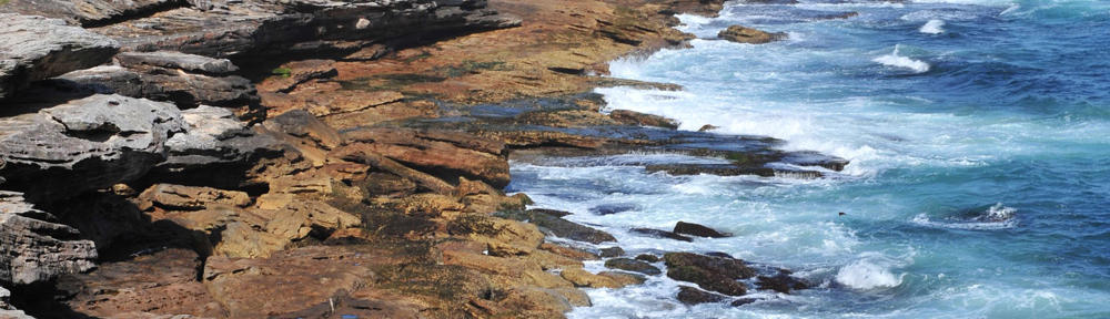
Information Forestry, April 2004 — A sliver of road remains—a narrow strip of asphalt running from bridge to barren clearing at river’s edge. Pavement once covered that, too, when it had served as loading area for the island’s dock. To the north and south, thickets of Douglas-fir, Sitka spruce and western redcedar grow. Along the waterfront, terraces built into banks support willows and other species that stabilize the shore and provide shade and shelter to sensitive salmon spawning grounds.

The greenery belies the island’s recent past: for almost 50 years, a sawmill and a cedar-shake mill operated on Baikie Island, in the Campbell River estuary, on the east coast of Vancouver Island. Sloughs separating the island from the foreshore were dredged for log booming and storage. Trucks lumbered on and off the island; tugboats herded log booms from upriver; the island bustled and roared.

The Nature Conservancy of Canada bought the island in 2000, and turned it over to the District of Campbell River to be restored and managed as a nature reserve and park. Sign of industry has been slowly disappearing from the island.

“Some things are coming back on their own,” says District of Campbell River Parks & Recreation Supervisor Susan Simson. “We’re helping other things along. There are places where we’d removed pavement that needed a lot of site preparation. Nothing grows there—not even broom or alder, and they’ll grow just about anywhere.”

This summer, volunteers dug up hard-packed ground once covered by industry, carted away industrial-grade fill, brought in tonnes of soil and compost, and planted the beginnings of a new forest. While local citizens provided most of the labour, part of a $27,000 grant given to the district government by Natural Resources Canada for new forest plantings helps pay for equipment, materials, and hundreds of seedlings still to be planted.

Fast-growing Forest 2020

The funding comes from a $20-million national pilot called Forest 2020 Plantation Demonstration and Assessment, part of the federal government’s $1-billion Climate Change Plan for Canada. Administered by the Canadian Forest Service, Forest 2020 encourages industry, local governments, First Nations, and other landowners to establish plantations of fast-growing trees on unforested land. By late 2007, new plantations of trees producing more than 13.6 centimetres of growth per hectare per year—eight times the national tree-growth average—will be growing on 10,000 hectares across the country. To date, 38 projects under the program are underway or planned in British Columbia.

In most of Canada, fast-growing trees mean hybrid poplars, larch, and Norway and white spruce. On the west coast, with its long growing season, many species—including Douglas-fir, Sitka spruce, cedar, maple, alder—super-produce fibre and quickly store carbon.

This enables west coast program participants such as the District of Campbell River to quickly rehabilitate and convert open areas back to green cover.

“We’re putting back what was originally there,” says Simson, of Baikie Island. “A conifer mix, with some other trees—native maples, willows, maybe some more cottonwoods along the estuary.”

The primary goal of Forest 2020 is long-term carbon sequestration, says Dean Mills (dmills@pfc.cfs.nrcan.gc.ca), who administers the program in British Columbia. Carbon dioxide is a greenhouse gas, and must be accounted for under the Kyoto Protocol for Climate Change, which Canada endorses. Trees take carbon dioxide from the air, and transform the carbon into wood: fast-growing trees do it faster. Carbon eventually stored within Forest 2020 plantations will be tallied in Canada’s accounting of the country’s greenhouse gas emissions, as required under the protocol.

“Forest 2020 allows for a shift in how we view the forest plantations,” says Mills. “Plantations and forests have many functions and can be used for more than just fibre. As long as Forest 2020 plantations sequester carbon at the prescribed rate, they can address other values such as quality of life or wildlife or economic development or other community objectives.”

Although wildlife, fisheries and local citizens benefit directly from the Baikie Island restoration, there are indirect payoffs. Campbell River is slated to become a stop on the cruiseline route to Alaska in 2005: new forests on nearby Baikie Island and other riverside lands will provide an inviting introduction to the town for shipboard visitors. In recognition of that, the district recently passed bylaws limiting development along the estuary to light-industrial or commercial use: existing heavy industry will gradually phase out, leaving the estuary to birds, fish, deer and people using pathways and picnic areas.

“Baikie Island is really a high-profile project within this community,” Simson says. “Support has been amazing. The Campbell River Noon-Hour Rotary Club built trails and pedestrian bridges. The Discovery Coast Greenways Land Trust brings in many volunteers every spring to remove broom and blackberries and other invasive species. The Nature Conservancy is involved, the Department of Fisheries and Oceans, BC Hydro… a lot of people and organizations are making things happen.”

The ultimate waste-recycling loop

Baikie Island is one of two Campbell River projects benefiting from Forest 2020 funding. Further inland, the district government invested the rest of the federal grant in a hybrid-poplar plantation that will eventually provide pulp fibre.

The plantation will not only bring in cash to help pay for itself, it saves the region money. Instead of paying to store and ship biosolids from the region’s 10-year-old waste-treatment plant for re-use elsewhere, engineers use the material to fertilize the plantation, which is located next to the treatment plant.

“This project had great potential because we owned a large piece of land around the plant, which eliminates transportation costs altogether,” says District of Campbell River Engineering Supervisor Ron Neufeld. “It turned out, after we’d done all the necessary field tests of the site, the project was not only a good match financially, but had all the right check marks in terms of soil, groundwater and other environmental conditions.”

The province’s regulations for recycling organic matter Recycling require a number of processes and conditions, including public consultation, site security and site preparation, to be met before a project like this can proceed. At two public meetings hosted by the district to discuss the project, the only concern raised by local residents was the possibility of odour, a problem the district has effectively minimized through appropriate application techniques. Following the public process, the site was fenced and cleared of bushes, and surrounded by a buffer zone and perimeter ditches.

After an initial spring application of biosolids in May, poplar whips were planted at four-metre intervals in rows covering 10 hectares of the site.

The trees received one more application of biosolids fertilizer during the summer months. “The number of applications and the rate of application depends on demand,” Neufeld says. “As the trees grow, demand will increase.”

Plantations are a cost-effective way to deal with Campbell River’s biosolid waste and improve the environment.

“We anticipate that the poplar crop will be ready for market in 10-13 years,” Neufeld says. “Once mature, the trees would likely be used for production of paper – maybe even toilet paper, which would really create an appropriate re-use cycle for this project.”


Caption: Ten hectares surrounding Campbell River’s waste-treatment plant were prepared and planted with hybrid poplars this spring, which will recycle biosolids from the plant into wood fibre.


Caption: Fragments of rare riparian forest communities survived Baikie Island’s industrial past, and are being augmented by Forest 2020 seedlings planted by volunteers.

Sidebar: Under Forest 2020, 10,000 hectares…

of non-forested land will be converted to fast-growing tree plantations by 2007.

of fast-growing trees planted by 2007 could sequester as much as 0.4 Megatonnes of carbon each year by 2012, the end of the Kyoto Protocol’s first commitment period.

IF April 2004. p6-7