
Information Forestry, August 2006 —Budworms are among the most destructive forest insects in North America. During outbreaks, eastern spruce budworm, western spruce budworm, jack pine budworm and their relatives strip foliage from tens of thousands of hectares of susceptible conifers across the continent.

Western spruce budworm is one of several budworm species that eat evergreen needles in Canada's conifer forests.
Now, thanks to indicators identified by Canadian Forest Service scientists, forest managers may be able to use simple chemical analyses to identify areas at particular risk to budworm outbreaks. Insect Ecologist Vince Nealis and Research Scientist Jason Nault plotted changing chemistry within developing Douglas-fir needles against the ability of western spruce budworms to feed successfully on the trees’ buds. From that, they determined that the same molecular compounds that give evergreens their distinctive smell also indicate the potential success of budworms in a given year.
“An important part of the life history of the budworm has to do with how well it is synchronized with the flush of new buds in the spring,” says Nealis. “We wanted to quantify the relationship between emergence of western spruce budworm and development of the insect’s preferred food, Douglas-fir buds.”
Key to the prediction method is a mixture of complex, aromatic hydrocarbon molecules, called terpenes, found in all evergreen needles. The proportions of different terpenes in the mixture within buds change rapidly, but predictably, as buds develop in the spring. The rate of progression from one dominant terpene to another is closely tied to site temperature. In cooler places or during cooler years, the progression—and bud development—occurs more slowly. This can upset the timing of budworm emergence to bud suitability, with consequences to outbreak risk.
According to retired, now-volunteer U.S. Forest Service Research Entomologist Karen Clancy, who studies resistance in Douglas-fir to western spruce budworm, budworm population success depends on that timing. “Phenology of bud break is probably the most important factor driving resistance in individual trees to western spruce budworm damage, and driving budworm population dynamics.”
Western spruce budworm emerges from its winter shelters in early spring and subsists on older Douglas-fir needles and pollen cones until its preferred food—tender, developing buds—comes into season. If larvae emerge too early or if bud development is delayed, greater numbers of budworms die, and that particular forest stand may benefit from a year without an outbreak.
By measuring the terpene profiles of developing buds using gas chromatography, Nealis and Nault found they can pinpoint where and when host trees would be most suitable for budworm outbreak in a given year and where the risk of damage is greatest. Knowing this allows forest managers to better plan and implement pest management options, and better manage forests in their care.
“They appear to have found a good, reliable, relatively easy way to measure the bud break phenology of individual trees and populations of trees,” says Clancy. “Measuring bud break phenology with other methods like going out and collecting samples and visually assessing each of the buds is very time consuming. If you can clip just one branch from a tree and analyze its foliar terpenes, that’s a phenomenal result.”
Although Nealis and Nault identified the correlation between terpene profile and bud suitability for budworm by performing linked biological and chemical assays on western spruce budworm and its host, Douglas-fir, Nealis suspects “the method can be applied to jack pine budworm or eastern spruce budworm or any of the other budworms.”

Scents of suitability
Terpenes, the molecules that give conifers their distinct smell, indicate tree-bud suitability to budworm attack. In linked chemical and biological assays of foliage from test trees at eight sites in British Columbia’s interior, Canadian Forest Service researchers identified terpene profiles that can be used to predict host suitability for the insect, severity of defoliation, and identify tree resistance to budworm damage.
© Natural Resources Canada 2006
Information Forestry, April 2004 — A sliver of road remains—a narrow strip of asphalt running from bridge to barren clearing at river’s edge. Pavement once covered that, too, when it had served as loading area for the island’s dock. To the north and south, thickets of Douglas-fir, Sitka spruce and western redcedar grow. Along the waterfront, terraces built into banks support willows and other species that stabilize the shore and provide shade and shelter to sensitive salmon spawning grounds.
The greenery belies the island’s recent past: for almost 50 years, a sawmill and a cedar-shake mill operated on Baikie Island, in the Campbell River estuary, on the east coast of Vancouver Island. Sloughs separating the island from the foreshore were dredged for log booming and storage. Trucks lumbered on and off the island; tugboats herded log booms from upriver; the island bustled and roared.
The Nature Conservancy of Canada bought the island in 2000, and turned it over to the District of Campbell River to be restored and managed as a nature reserve and park. Sign of industry has been slowly disappearing from the island.
“Some things are coming back on their own,” says District of Campbell River Parks & Recreation Supervisor Susan Simson. “We’re helping other things along. There are places where we’d removed pavement that needed a lot of site preparation. Nothing grows there—not even broom or alder, and they’ll grow just about anywhere.”
This summer, volunteers dug up hard-packed ground once covered by industry, carted away industrial-grade fill, brought in tonnes of soil and compost, and planted the beginnings of a new forest. While local citizens provided most of the labour, part of a $27,000 grant given to the district government by Natural Resources Canada for new forest plantings helps pay for equipment, materials, and hundreds of seedlings still to be planted.
Fast-growing Forest 2020
The funding comes from a $20-million national pilot called Forest 2020 Plantation Demonstration and Assessment, part of the federal government’s $1-billion Climate Change Plan for Canada. Administered by the Canadian Forest Service, Forest 2020 encourages industry, local governments, First Nations, and other landowners to establish plantations of fast-growing trees on unforested land. By late 2007, new plantations of trees producing more than 13.6 centimetres of growth per hectare per year—eight times the national tree-growth average—will be growing on 10,000 hectares across the country. To date, 38 projects under the program are underway or planned in British Columbia.
In most of Canada, fast-growing trees mean hybrid poplars, larch, and Norway and white spruce. On the west coast, with its long growing season, many species—including Douglas-fir, Sitka spruce, cedar, maple, alder—super-produce fibre and quickly store carbon.
This enables west coast program participants such as the District of Campbell River to quickly rehabilitate and convert open areas back to green cover.
“We’re putting back what was originally there,” says Simson, of Baikie Island. “A conifer mix, with some other trees—native maples, willows, maybe some more cottonwoods along the estuary.”
The primary goal of Forest 2020 is long-term carbon sequestration, says Dean Mills (dmills@pfc.cfs.nrcan.gc.ca), who administers the program in British Columbia. Carbon dioxide is a greenhouse gas, and must be accounted for under the Kyoto Protocol for Climate Change, which Canada endorses. Trees take carbon dioxide from the air, and transform the carbon into wood: fast-growing trees do it faster. Carbon eventually stored within Forest 2020 plantations will be tallied in Canada’s accounting of the country’s greenhouse gas emissions, as required under the protocol.
“Forest 2020 allows for a shift in how we view the forest plantations,” says Mills. “Plantations and forests have many functions and can be used for more than just fibre. As long as Forest 2020 plantations sequester carbon at the prescribed rate, they can address other values such as quality of life or wildlife or economic development or other community objectives.”
Although wildlife, fisheries and local citizens benefit directly from the Baikie Island restoration, there are indirect payoffs. Campbell River is slated to become a stop on the cruiseline route to Alaska in 2005: new forests on nearby Baikie Island and other riverside lands will provide an inviting introduction to the town for shipboard visitors. In recognition of that, the district recently passed bylaws limiting development along the estuary to light-industrial or commercial use: existing heavy industry will gradually phase out, leaving the estuary to birds, fish, deer and people using pathways and picnic areas.
“Baikie Island is really a high-profile project within this community,” Simson says. “Support has been amazing. The Campbell River Noon-Hour Rotary Club built trails and pedestrian bridges. The Discovery Coast Greenways Land Trust brings in many volunteers every spring to remove broom and blackberries and other invasive species. The Nature Conservancy is involved, the Department of Fisheries and Oceans, BC Hydro… a lot of people and organizations are making things happen.”
The ultimate waste-recycling loop
Baikie Island is one of two Campbell River projects benefiting from Forest 2020 funding. Further inland, the district government invested the rest of the federal grant in a hybrid-poplar plantation that will eventually provide pulp fibre.
The plantation will not only bring in cash to help pay for itself, it saves the region money. Instead of paying to store and ship biosolids from the region’s 10-year-old waste-treatment plant for re-use elsewhere, engineers use the material to fertilize the plantation, which is located next to the treatment plant.
“This project had great potential because we owned a large piece of land around the plant, which eliminates transportation costs altogether,” says District of Campbell River Engineering Supervisor Ron Neufeld. “It turned out, after we’d done all the necessary field tests of the site, the project was not only a good match financially, but had all the right check marks in terms of soil, groundwater and other environmental conditions.”
The province’s regulations for recycling organic matter Recycling require a number of processes and conditions, including public consultation, site security and site preparation, to be met before a project like this can proceed. At two public meetings hosted by the district to discuss the project, the only concern raised by local residents was the possibility of odour, a problem the district has effectively minimized through appropriate application techniques. Following the public process, the site was fenced and cleared of bushes, and surrounded by a buffer zone and perimeter ditches.
After an initial spring application of biosolids in May, poplar whips were planted at four-metre intervals in rows covering 10 hectares of the site.
The trees received one more application of biosolids fertilizer during the summer months. “The number of applications and the rate of application depends on demand,” Neufeld says. “As the trees grow, demand will increase.”
Plantations are a cost-effective way to deal with Campbell River’s biosolid waste and improve the environment.
“We anticipate that the poplar crop will be ready for market in 10-13 years,” Neufeld says. “Once mature, the trees would likely be used for production of paper – maybe even toilet paper, which would really create an appropriate re-use cycle for this project.”
Caption: Ten hectares surrounding Campbell River’s waste-treatment plant were prepared and planted with hybrid poplars this spring, which will recycle biosolids from the plant into wood fibre.
Caption: Fragments of rare riparian forest communities survived Baikie Island’s industrial past, and are being augmented by Forest 2020 seedlings planted by volunteers.
Sidebar: Under Forest 2020, 10,000 hectares…
of non-forested land will be converted to fast-growing tree plantations by 2007.
of fast-growing trees planted by 2007 could sequester as much as 0.4 Megatonnes of carbon each year by 2012, the end of the Kyoto Protocol’s first commitment period.
IF April 2004. p6-7

Sample pages from Ornithomimus: Pursuing the Bird-Mimic Dinosaur, by Monique Keiran. Published by the Royal Tyrrell Museum of Palaeontology and Raincoast Books, 2002.
Trackways #19, Winter 1999–A nearly complete Cretaceous-aged turtle has found its way to the Royal Tyrrell Museum. Not only are its skull, skeleton and shell intact, but its body cavity contains additional treasure: turtle eggs.
“The preservation of this specimen is remarkable,” says Museum palaeontologist Don Brinkman, who studies Cretaceous turtles. “Of all the turtle specimens found all over the world, there is only one other I’ve heard of that may also contain eggs.”
Found by Museum technician Wendy Sloboda in the remains of an ancient mud-filled channel, the turtle’s bones escaped reworking and scattering by scavengers and water currents. The specimen is Adocus, an extinct relative of today’s soft-shelled turtles. Seventy million years ago, it swam in freshwater streams and ponds, ate fish, frogs and salamanders, and likely came ashore to lay its eggs on warm, sandy beaches. However, this individual died before laying its eggs: its body is filled with dozens of eggs compressed by burial.
“We have more research to do before we learn all this specimen can tell us,” Brinkman says. “At the very least, we now know for sure that Adocus laid eggs and what Adocus eggshell looks like. This will help us identify in the future when we find shell fragments in the field.”
© Royal Tyrrell Museum of Palaeontology 1999
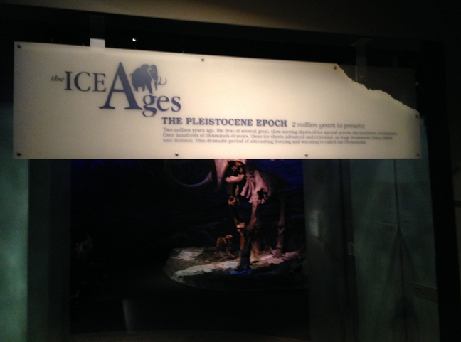
The Pleistocene Epoch
2 million years to present, at the Royal Tyrrell Museum of Palaeontology, Drumheller, Alberta
The Royal Tyrrell Museum opened the Ice Ages Gallery in 1999. A collaboration between curators, technical staff, the exhibits team and others, it tells the story of Alberta from two million years ago to the present—the time called the Pleistocene, when huge mammals roamed, great ice sheets came and went, and humans first arrived in North America.
I prepared the text for the panels and labels. Browse through the image gallery below for a view of gallery displays and signage. To read the signage, click on the image.

Glacial ice and meltwater shaped the landscape and affected the climate. A patchwork of grassland, parkland and other habitats developed, known as the Mammoth Steppe. Resembling a cold version of Africa’s savanna, the steppe environment allowed mammoths and other herbivores to flourish.
–Sign text by M. Keiran

Represented here by a mother and her calf, the American mastodon inhabited forested areas and lacked the grazing adaptation of its larger relative, the mammoth. Low-crested teeth indicate it browsed softer vegetation.
Mammut americanus
Utah
–Sign text by M. Keiran

The Pleistocene is known for big mammals. Ground sloths as tall as African elephants. Giant bison with horns that panned more than two metres.
Step up and see how you compare in size to the animals of the Pleistocene
–Sign text by M. Keiran

The modern bison roamed the plains of North America in vast herds. As the mainstay of the region’s first people, they were hunted for food, clothing and shelter. Now, bones and few rubbing stones are all that remain of their existence.
Bison bison
Alberta
–Sign text by M. Keiran

Why did the incredible diversity of Pleistocene fauna disappear?
Were Ice Age animals so specialized, they couldn’t adjust to changing environments after the last glaciation?
Did humans wipe out entire populations with their weapons and hunting techniques?
Did animals migrating from Asia outcompete North American species?
Did animals entering North America bring new, deadly diseases?
Or, was it a combination of factors that led to the Great Extinction?
–Text by M. Keiran

Dying out over 20,000 years ago, the giant bison may have been solitary browsers and grazers of open woodlands. Larger than their modern relatives, their horns were more than three times the size of horns on today’s buffalo. The span of the ancient horn cores indicates the extreme length of the horns.
Bison latifrons
Idaho
–Sign text by M. Keiran

The prairie dogs that lived in these fossilized burrows 22,000 to 33,000 years ago were the largest known—some 15% bigger than modern descendants like the one in this photo.
Cynomus ntobrarius churcherii
Handhills, Alberta
–Text by M. Keiran

The grasslands of Ice Age Alberta supported a greater diversity and abundance of animals than today’s African savanna.
Rhinoceroses, camels and donkey-like horses lived alongside lions, cheetahs, bears, beavers, mammoths and mastodons.
—Text by M. Keiran

A relative of the modern tree sloth, the ground sloth migrated from South America. This species is small compared to other ground sloths—some were as large as African elephants.
Glossotherium sp.
Rancho La Brea, California
–Sign text by M. Keiran

The extinct dire wolf howls at the end of the Pleistocene. A close cousin to the timber wolf, dire wolves lived in packs and hunted large herbivores such as horses and bison.
Canis dirus
California
–Sign text by M. Keiran


With the introduction of new species to North America came a new predator. Humans quickly spread from Asia through North and South America. Using stone and bone tools and weapons, they thrived in these rich hunting grounds and may have caused the extinction of many large Pleistocene animals.
–Text by M. Keiran
Legacy: Alberta’s Heritage Magazine, May–June 1999—
It is a sudden thing and takes you by surprise. As you follow the long curve in Highway 9 northeast of Calgary, the immense, rolling prairie breaks on the left, opening into a narrow valley, worn by weather and softened by summer colours.
You have time only to glance before it is gone from sight.
The appearance of Horseshoe Canyon is so sudden and so unexpected, it rates as one of the most spectacular introductions to Alberta’s badlands. Seventeen kilometres east of Drumheller, Horseshoe Canyon is often a visitor’s first glimpse of this bizarre and haunting landscape.
A roadside recreation area was meant to accommodate those who stop to look, but tourists had overrun the adjacent field. Just a few years ago, the landowners were so frustrated with the damage, they considered selling the site to a golf course developer.
Along came Leila Nodwell. To change the Horseshoe Canyon experience, Nodwell and her son built and opened the Horseshoe Canyon Interpretive Centre in 1997. For one summer, they ran bus tours into the canyon on a leased half-section of land beyond the recreation area. What started out as a market for their family-built glacier tour buses turned into a passion and a dream for Nodwell. When the buses proved unviable, she remained, bewitched in a way, by the site’s eerie beauty. She committed to preserving and sharing it with visitors.
“It’s a very special place. These are the first badlands people encounter on their way out from the city, and they make such an impression. Ther was so much potential here for educating people, having them experience the badlands and making them care.”
Access to the land is free, but Nodwell provides additional opportunities for visitors to explore it and, in particular, given visitors who would otherwise be unable to experience the badlands the chance to travel within them.
“I love grandfathers who bring their grandchildren,” says Nodwell. “Many grandpas can’t walk into the canyon with the kids, but they can drive. And they can do something exciting and interesting together. It gives them adventure and something they can learn about together.”
The all-terrain buggies that visitors now drive into the canyon have been adapted by engineers especially for the site, have seats for eight people, and include an audio tour and printed information about points of interest along the way. Starting this summer, visitors can also sign up for guided hikes of the canyon. The preserve the area, Nodwell asks visitors to sign an agreement that they will not take anything form the site or damage the fragile badlands by driving buggies off-road or hiking off designated paths.
Preservation is one of Nodwell’s biggest concerns. Another is that nobody will listen or care. She faces everything from bureaucracy and red tape to the sometimes agonizingly slow process of developing awareness among local residents and visitors. She is exploring partnerships with like-minded agencies to help protect the site—the western chapter of the Nature Conservancy of Canada has expressed interest—and is even investigating World Heritage Site designation by the United Nations.
With little background in ecology, geology, or tourism management, Nodwell is learning as she goes. In three years, she has learned about prairies and badlands, their formation throughout geological history, and the plants and creatures that call them home. She has studied the human history of the area and is acquiring knowledge and experience necessary to manage and market a conservation and ecotourism venture.
Partnerships are a vital part of her strategy and the centre’s development. Near the interpretive centre stands a tipi made and painted by a family from southern Alberta’s Siksika Blackfoot Nation. Its presence highlights use of Horseshoe Canyon by First Nations peoples prior to settlement of the area—archaeological sites on Nodwell’s half-section include a quarry and a hearth. Shortly after the tipi was erected, Nodwell and the family discussed it and its paintings. The resulting booklet is a available in the interpretive centre.
“There is such a hunger, especially among European visitors, for this kind of information. I though this would be a great way to tell of them of the First Nations presence here. It is such an important story and needs to be told,” she says.
Other partnerships assist with returning the weedy turf on the edge of the canyon to its former prairie glory. With a horticultural acquaintance, Nodwell researched prairie plants and planted native wildflowers around the interpretive centre’s foundations. Last spring, an agriculturalist volunteered time and expertise to sprout native grass seed donated by a southern Alberta company. Nodwell planted thousands of blue grams, rough fescue, little bluestem, spear and wheat grass in demonstration plots around the building. The new plants thrive next to the strip of transplanted, unploughed sod that was salvaged from the edge of the canyon before construction crews arrived to build the facilities in early 1997. Where canola and thistles bloomed three years ago, native wildflowers and grasses are reappearing as the Dry Land Wild Flower and Natural Grasses Exhibit. Nodwell hopes to, in time, have the site look like it did a century ago.
“You know what I’d like?” she asks. “When the project is finished, I’d like the garden to be on par with Victoria’s Butchart Gardens and draw people from all over the world just to look at the prairie flowers and grasses. This place could be a real showcasefor native prairie landscaping.”
The Horseshoe Canyon Interpretive Centre project itself could be a showcase for what a dream and a little passion can accomplish. Nodwell has, almost singlehandedly, transformed a site threatened by a golf course and heedless sightseers into a place where visitors can experience and learn about an important part of southern Alberta’s landscape and history.


