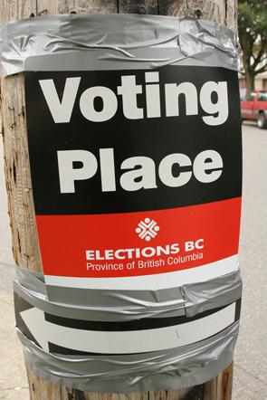
Sign for voting place. Photo by Roland TanglaoAdvance voting in B.C.’s provincial election closes today. Pollsters and pundits are pontificating on what it all means for Tuesday’s general vote. Meanwhile, I ponder how my own biases, tendencies and other psychological traits influence my perceptions of this election campaign.

Elections build community. The electoral process involves and engages (some) citizens. It commits them to common cause and values.

But communities, like nations, come with borders. Who and what are excluded defines a community as much as who and what are included.

And many election campaigns focus more on building fences around similarities than on building bridges between differences. Parties seeking election strive to distinguish themselves from the pack. They also work to define their communities, so they can efficiently entrench that support and effectively woo voters just beyond — but not too far beyond — the boundaries.

Nonetheless, the process of “building community” via democratic election can be divisive. There’s nothing like an election with one or two emotional issues to emphasize differences.

Our biases and tendencies have been shown to be subconscious and uncontrollable, even when we know they exist and how they manifest, and try to guard against them.

Let’s peek into our psyches to see how some social-psychological factors might influence us at election time.

Continue reading at the Victoria Times Colonist….

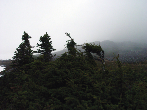
High-altitude krumholtz in British Columbia, photo by Kevin Teague
Information Forestry, December 2012

British Columbia is home to some of Canada’s highest-elevation forests. In the very highest of these—growing at treeline in or near the true alpine—evergreens hug the ground, twisted and bent by wind and snow pack, with vertical leaders repeatedly pruned by severe winter temperatures, ice, and wind. Many models that predict how changing climate will affect species distribution assume temperature limits both growth and spread of these forests. As global temperatures rise with climate change, these models forecast the forests will straighten, grow tall, and colonize ever-higher slopes.

However, a recent study by Natural Resources Canada Research Scientist Eliot McIntire suggests these assumptions need re-examination. McIntire and colleague Alex Fajardo, of the University of Montana, tracked growth at high-altitude treelines in the Chilean Andes and Montana’s Rocky Mountains. Basal tree cores at the sites show tree growth and colonization up the slopes improved for most of the past 200 to 300 years. This corresponds to a period when global temperatures were just beginning to climb to today’s levels out of the very coldest decades of the last millennium.

“Synchrony between temperature and growth and temperature and recruitment clearly occurred during that period in both regions,” says McIntire. “Then, during the past half-century, it was lost at all sites.”

In fact, any improvements in growth that had occurred have since disappeared or reversed.

This decoupling of temperature and high-altitude growth and recruitment rates may indicate that the world is entering a period in which temperature no longer drives growth and colonization at treelines, McIntire says. Other factors, such as availability of water, may now be the main constraints.

The findings suggest climate models may need to be modified to separate high-altitude growth and recruitment drivers if they are to capture what is really going on under British Columbia’s—and the world’s—highest forest canopies.

© Natural Resources Canada 2013

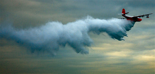
Mars Waterbomber bombing, photo by ToddBF, flickr

Information Forestry, December 2012—The biggest challenge in forecasting fire-season resource needs in Canada, says Canadian Forest Service Forest Inventory and Analysis Research Scientist Steen Magnussen, is the variability in the country’s fire regimes.

“The environment, the size of Canada, the weather, the forest structure, larger climate patterns, the fire danger—all that combines to create the variability that we face year to year, location to location,” he says. “That’s why it is so difficult to predict how many resources are going to be needed anywhere and at any one time across the country.”

Borrowing methodologies from the insurance industry, Magnussen has developed a statistical framework that captures the variability and other key characteristics of Canada’s fire regimes on a weekly basis. The framework enabled him and Natural Resources Canada Fire Officer Steve Taylor to estimate how fire events in Canada are distributed in relation to one another across and between 48 regions and throughout a fire season.

“Resource sharing works because we don’t usually get major fires occurring in different regions at the same time,” Magnussen says. “We wanted to see if that pattern is stable enough that we could do estimates of likelihood: What is the probability of one, two, three provinces experiencing peaks in fire activity at one time?”

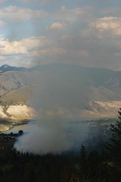
Kelowna fire, photo by Pierre Gazzola

The resulting fire-event distribution revealed that, in recent decades, Ontario’s fire numbers tend to peak in spring, after snowmelt but before the forest greens up. British Columbia’s fire season usually peaks later in the summer—after drought sets in—as happened with the 2003 Kelowna fire.

“This lack of synchrony is essential,” Taylor says. “How many regions aren’t experiencing fire-occurrence peaks when other regions are? And which regions? Not all jurisdictions have the same amount of resources. For resource sharing to work, it’s important to track synchrony and asynchrony with regard to those resource-wealthy regions.”

The study is the first step in a project Taylor is leading to determine possible effects of climate change on future fire-resource sharing. “We needed to assess the current situation: What are the chances of peak overlap occurring between jurisdictions now?”

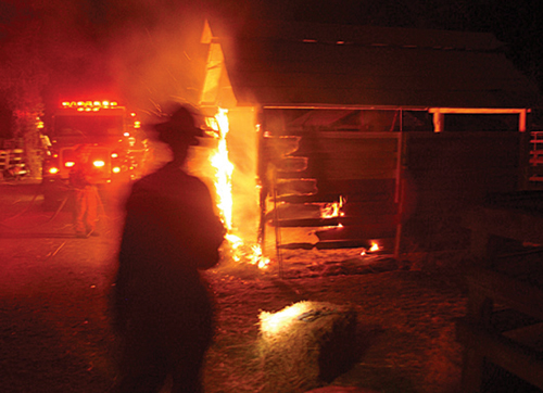
Fire in the British Columbia Interior, photo by Digital_Image_fan, Flickr

One of the questions Taylor and Magnussen wanted to answer was whether daily, weekly, or biweekly patterns in historical use of fire-fighting resources exist. The amount of data on resource use exists only for the last 25 years, and even that is inconsistent and in some places non-existent.

“Most fire-management agencies don’t track number of firefighters or number of person days,” Taylor says. “They can tell you what was used through a season, but not on a day-by-day basis. Even for a particular fire, it can be hard to find that information.”

With fire patterns and the statistical joint distribution of fire events now mapped and established in time and space, fire managers can use the system created by Magnussen to determine the likelihood of various fireevent scenarios across the country. And when resource-needs information for individual fires becomes available, the system will enable fire managers and researchers to quantify opportunities for and constraints on sharing resources across jurisdictions.

 © Natural Resources Canada 2012

Victoria Times Colonist, November 23, 2012—The words “isle” and “isolation” share linguistic roots. Both derive from the Latin word insula, which itself gives us the word “insulate”.

A curious thing can happen to large-ish mammal species that live on isolated, insulated isles. Over long periods of time, some species become smaller.

This phenomenon is called island, or insular, dwarfism. Scientists believe it results from the limited food resources typically available on islands and in other geographically cut-off areas.

In the short term, food deprivation leads to smaller birth weights and decreased growth in mammals. Over the long term, smaller bodies require less energy, or food.

Think of how much a football player or a basketball player or, better yet, a Sumo wrestler eats to maintain muscle mass and energy levels.

When food is persistently scarce, being petite confers a survival advantage.

And, so, over time, mammals on the large side when they live on mainlands may shrink in size when marooned for generations on desert isles.

(Gilligan, the Skipper, too, the millionaire and his wife, and the rest of S.S. Minnow gang weren’t stranded on their island long enough to show the effects….)

Living examples of island dwarfism include the Key Deer, found only on the Florida Keys. The Channel Island fox is the world’s smallest fox. It is native to California’s—you guessed it—Channel Islands.

Here on the B.C. coast, we have the Sitka deer on Haida Gwaii. Columbian black-tailed deer that live on the smaller Gulf Islands tend to be smaller than their mainland cousins. This, despite the abundant shrubberies and other garden delicacies we provide year-round.

Extinct species include dwarf ground sloths in the Caribbean, dwarf elephants in the Mediterranean and small elephant-like creatures in Southeast Asia. The Philippines once were home to small buffalo. Indonesia’s Bali boasted the smallest tiger of all until it went extinct in the last century.

And so, when B.C. Ferries raises rates and cuts service, and adds to the existing physical isolation of B.C.’s islands, the spectre of island dwarfism raises its tiny cranium in my own tiny cranium. As a science nerd, when I hear of the ferry corporation’s proposed cuts to meet budget constraints, I sigh and think of the Hobbit.

Not Bilbo Baggins. Nor the Peter Jackson movie due out mid-December. I’m talking about Homo floriensis, that wee relative of modern humans whose remains were discovered by archaeologists on the Indonesian island of Flores in 2003.

Partial skeletons of nine individuals were uncovered, dating from 95,000 to 13,000 years ago. The tallest would have stood 87 centimetres tall when alive. Hence the nickname, the “Hobbit.”

As ferry service is cut, as it and the options of flying or watertaxi-ing to and from the islands become ever more costly, what with increases in fares, fuel surcharges, airport and dock fees, parking costs, security levies, carbon taxes, cost of living, etc., etc., will our fate as Island residents be to grow ever smaller, as Hobbit Man (and Woman) did on Flores those millennia ago? Will our descendants follow the eventual path to petite-ness taken by the Sitka and local Columbian black-tailed deer? Will we, too, nibble our neighbours’ shrubberies when food imports from the mainland become too expensive? Will decreasing physical contact betwixt mainland and island eventually result in a new hominid species, our very own Homo vancouverislandensis?

Is this the destiny we choose when we choose to continue living here?

Okay, all smart-aleck questions, but the question of choice underlies them.

And it is a choice. Unlike deer, cougar or bear, we choose to live here, despite the cost of living, inconvenience, and limited employment in some fields.

More accessible and affordable alternatives exist… some, where employers are even hiring. Alberta, Saskatchewan, New Brunswick, and Nova Scotia, for instance. Where it snows more.

We choose this place.

We must also accept the consequences of that choice.

********************************************************

Note: Nature Boy, wildlife expert, assures me island dwarfism won’t happen in our lifetimes, regardless of the outcome of BC Ferries’ current public consultations or its coming service cuts and fare increases.

“I keep hearing about island dwarfism,” he says, “but I’ve lived here for more than a decade and, well, I just keep getting bigger.”

—30—

A version of this article appeared in the Victoria Times Colonist.
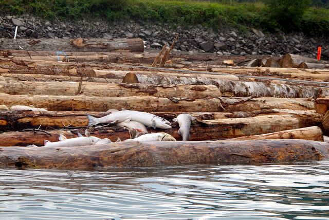
dead salmon, by Christopher Porter

Victoria Times Colonist, November 17, 2012—October’s turn in weather, bringing rain after months of sun and heat, has at last raised water levels  on the Cowichan River and cleared the way for the salmon.

How nice that something can enjoy the end to the glorious summer we had.

Just six weeks ago, the river nearly ran dry along some reaches. Salmon returning to the river found their passage upstream blocked by low water.

. Volunteers started rescuing the salmon. They trapped the fish, trucked them upstream, and released them at Sandy Pools and Skutz Falls.

But a month of rain has replenished river levels. I visited Skutz Falls a few weeks ago. There was still insufficient water to fill the fish ladders around the rapids, but Coho and Chinook were flinging themselves up the river’s natural white-water channels.

They are once again fulfilling their biological destinies by returning to their birthplace to reproduce.

And die.

The salmon’s instinctual call to destiny is a strange and wonderful thing. It places greater value on the interests of future generations than on any individual fish’s survival.

We could learn from that.

The problems on the Cowichan River stem from too much water being released via the Cowichan Lake weir earlier this year, leaving too little to buffer the river from severe drought six months later. But what happened here reflects river-flow problems across North America.

In Prince Edward Island, rivers were so low and warm this fall, fish became scarce. In the U.S., 160-kilometres of Nebraska’s Platte River dried up completely, and the mighty Mississippi fell by more than six metres.

Closer to home, below-average winter snowpack and months of dry, warm weather caused sections of rivers in the Peace Region to turn to mud and gravel. And on the Columbia River, annual flow has declined by more than 14 percent since 1950. One-third of the Columbia’s water originates in here in B.C.

What happens to the Columbia, the Kiskatinaw, the Moberly, the Beatton and the Cowichan can happen to the Fraser, the Skeena and, yes, the Goldstream and the Sooke.

After all, geologists report that Ontario’s Niagara and St. Clair rivers dried up completely 7000 years ago. A 25 to 40 percent decrease in annual precipitation and a 5o C rise in average temperatures caused water to evaporate faster from the Great Lakes than it was replaced. Lake levels dropped 20 metres, cutting off the rivers, shutting off Niagara Falls.

The study’s authors say similar temperatures and precipitation are within the range predicted for the region by 2100.

That is, what happened under climate change once can happen again.

Simon Fraser University researchers say we can expect a 20 percent drop in precipitation in B.C. by mid-century. Under climate change, spring and summer rains will decrease, and annual snow and ice accumulation in the province’s mountains and glaciers will decline. Glaciers store water in winter and release it slowly to rivers in summer. As glaciers disappear, late-summer river levels will fall drastically, right when demand for freshwater for agriculture, fisheries, industry and urban use increases.

Clearly, if these climate scenarios occur, B.C. rivers will experience increasingly difficult years.

British Columbians have always considered freshwater a renewable resource—one that falls from the sky like pennies from heaven. But when it ceases to splash down abundantly where and when it is needed, freshwater may become scarily scarce even here on the Wet Coast.

Kudos to the Capital Regional District for encouraging responsible water use. Despite a 14 percent increase in regional population, the CRD water board reports in its 2012 strategic plan that water use in the region has actually decreased by 11 percent since 2001. Seasonal watering restrictions, metering, rebates on water-efficient fixtures and appliances, and voluntary efficiency audits by businesses have brought about the gains, and will help extend our water supply.

However, more needs to be done by each of us.

It is time, while freshwater remains plentiful here, to learn from this year’s Cowichan River salmon, and reconsider how we each use and manage this resource now, so enough remains for future needs.

And for future generations of salmon.

–30–

A version of this column appeared in the Victoria Times Colonist.
miso soup, by Michael Ocampo: www.facebook.com/coolmikeolntwk

  Nov 10, 2012

There’s a ritual we go through every time we eat at a Japanese restaurant.

It starts when the miso soup is brought to the table. Nature Boy gives his a swirl with his chopsticks. Then he reverently bows his head over the bowl in silent contemplation.

This is no memorial ceremony for Japan’s recent natural and nuclear disasters. The ritual predates those events.

No misguided adaptation of the Japanese tea ceremony.

Nor is this grace.

No, this prayer-like pause is Nature Boy’s version of veneration for the geologic forces that shape our planet.

So it does, in a way, relate to the earthquake in Japan, and the ties between this coast and that coast. Ties that extend far beyond and deep beneath the more than two dozen Japanese restaurants that operate downtown and the hundreds of students who cross the Pacific every year to study English here. Ties that physically bind this island to those islands in the form of massive crustal plates underlying the ocean floor.

It also relates to the recent earthquake in Haida Gwaii.

For, as I have been informed—repeatedly—in every bowl of miso soup, the same thermodynamic forces that churn Earth’s interior and move continents across the surface of the planet convect clouds of soybean paste and shift shredded wakame and chopped scallions.

In every bowl of soup, a demonstration of plate tectonics.

Those same forces caused the Haida Gwaii trembler, and the recent earthquakes in Japan, Mexico, New Zealand, Chile, Alaska, off the coast of Indonesia, around the Pacific Ring of Fire and elsewhere.

The soup itself represents Earth’s mantle, the region of the planet’s liquid interior between solid crust and solid core. The micro-curd miso suspended in the liquid enables The Interested Observer (a.k.a. Nature Boy) to identify convection currents within the soup. Soup at the surface, exposed to restaurant air, cools more rapidly than soup deeper within the bowl. Cool fluid is denser than hot fluid, so it sinks—gravity having its inexorable way. Hot fluid is less dense, so as the cooler liquid sinks, the hot stuff rises to the surface, where it subsequently cools, densifies, and sinks. And so on.

The cycling fluid creates troughs and wells, and pushes the soup’s floaty bits around the surface. Nature Boy gets particularly excited when a piece of seaweed wedges beneath some chopped scallion. He is sure to point out—yet again—the similarities to the Juan de Fuca Plate being driven under the North America Plate in the Cascadia Subduction Zone beneath Vancouver Island.

And I point out the similarities to how my cornea subduct under my eyelids when I roll my eyes.

“That,” he says, “is not at all the same.”

Pause.

“Okay, it is sort of the same.”

But a soup bowl is no crystal ball. No way to foretell a trembler’s timing, location, scale, or scope of impact exists. The October 27 earthquake caught Haida Gwaii residents by surprise. Tsunami alerts followed. Fortunately, despite the earthquake’s 7.7 magnitude, minimal damage occurred and only small ocean waves materialized.

Better to issue a warning when you’re uncertain than to wish you had afterwards.

New technology may provide some predictive potential. The seafloor-sensor network operated by NEPTUNE Canada, the Victoria-based underwater ocean observatory, and the instruments the Woods Hole Oceanographic Institute installed this year above the Cascadia fault monitor seafloor deformations. The sensors will provide minute-by-minute information about what is happening beneath our feet and off our shores.

If the data are analyzed quickly, they just might enable some warning of The Big One when it comes. Measurements of the fault zone where Japan’s earthquake happened revealed slow, small slip occurring two days before that quake. Seafloor monitors also detected movement. Unfortunately, the data weren’t analyzed in time to provide notice. Nor could anyone have known slow, small slip foretold a 9.0-magnitude shakedown in that case, or the size of the subsequent tsunami.

Greater warning might have made tremendous difference. It might mean all the difference for us.

Perhaps—just perhaps—we’ll have enough warning to gulp our soup and dash for stable, high ground.


A version of this article appeared in the  Victoria Times Colonist.

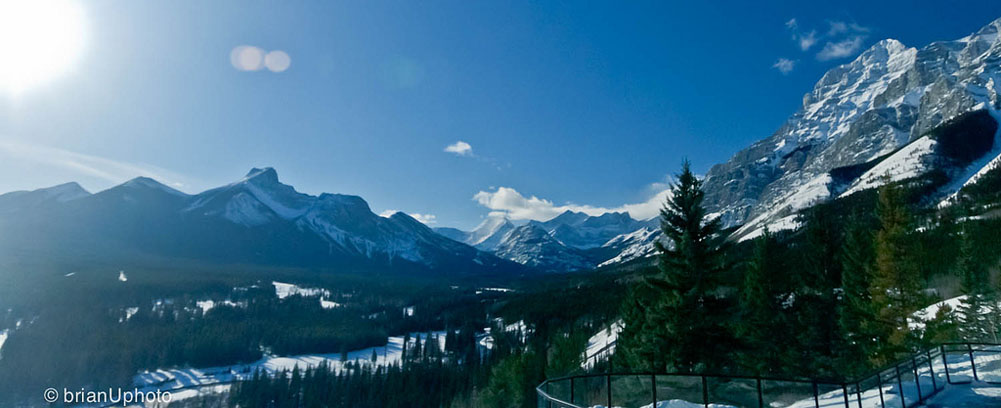
Kananaskis Country in winter. Photo by Brian Uhreen, http://www.flickr.com/photos/snype451/5644810651/

Although weather in Alberta’s mountains can be counted on to be unpredictable, when it’s sunny, it’s glorious. Photo by Brian Uhreen

Explore Kananaskis, Winter/Spring 1997Covering more than 5,000 square kilometres, Alberta’s Kananaskis Country encompasses everything from foothills in the east to the rock, alpine Continental Divide in the west, from the wide, windswept Bow River Valley in the north to narrow passes and valleys in the south.

With such variety in terrain, elevation and exposure, one of the few things you can count on regarding weather in the wilderness region is that is it unpredictable. The adage, “If you don’t like the weather, wait five minutes,” applies.

Winter – generally

Winter in Kananaskis starts in November and lasts until March. Unless it starts in September. Or ends in May. There are years when an early drop in seasonal temperatures lowers the snow line soon after Labour Day. There are as many years when winter blasts on and on until June, at which time summer arrives, bypassing spring altogether.

Duelling weather systems

Kananaskis Country generally has two continental weather systems in play during winter. Frigid, dry Arctic systems from north or east blow without resistance over the prairie until they smack into the Rocky Mountains. These ramparts of stone funnel and deflect the air-flow southward. The arrival of these systems usually means cold temperatures and ice crystals in the air. These systems can also dump snow in the foothills while bypassing points further west.

Contrast that with the Pacific weather that blows in from the west coast. These systems tend to be warmer than Arctic systems, and are laden with moisture that falls as rain in Vancouver and turns to snow as they are forced up the staircase of mountain ranges across British Columbia. By the time the systems arrive at Alberta’s western reaches, the majority of the moisture has already condensed into clouds and precipitated out on the western side of the Continental Divide.

The amount of snow lessens the further east a wintertime Pacific system extends. Thus, West Bragg Creek, on Kananaskis Country’s east side, receives less snow from these systems than does Peter Lougheed Provincial Park, abutting the Continental Divide to the west.

Elevation effects

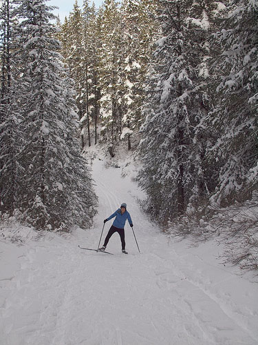
Cross-country skiing, in Kananaskis Country. Adam Kahtava photo - http://www.flickr.com/photos/kahtava/5213943879/

Kananaskis Country is home to some of the best cross-country skiing in Canada. Photo by Adam Kahtava.

Elevation influences the differences in snowfall and accumulation between east and west Kananaskis Country. The higher you go, the colder it gets, the more likely that what precipitation there is will fall as snow, not rain. Snow accumulates; rain does not.

However, to every rule, there is an exception. Although higher elevations usually do mean lower temperatures, diehard winter outdoor enthusiasts have been known to leave Calgary where it is –35° C and spend a sunny day on Peter Lougheed Provincial Park trails in balmy –10° C temperatures. This winter phenomenon is called temperature inversion, and occurs frequently in this part of the world. Arctic high-pressure systems spread a thin layer of cold, murky and sometimes polluted air over the prairies and foothills valleys. One of the warmer western systems—as much as 15° C warmer—sits above it, trapping the cold air below.

To find out when to take advantage of a temperature inversion, compare Environment Canada’s Calgary forecast to its Banff forecast. If it’s warmer in Banff, temperature inversion is occurring.


Chinooks: spring in February

Chinook Arch at Sunset. Photo by Tuchodi, http://www.flickr.com/photos/tuchodi/5381184500/

Chinook Arch at Sunset. Photo by Tuchodi

East–west differences in snow accumulation can also be affected by recurring Chinook winds. Chinooks are a distinctive part of the Pacific weather system: as many as 10 times each winter, they blow in from the west, gradually chilling and dumping snow as they climb the British Columbia mountain staircase. With one final dump on the Continental Divide, a now-near-dry Chinook wind flows down the mountains to the plains, skipping over the Rocky Mountain front ranges and foothills like a rock skipping over water. As the wind descends, its temperatures rise faster than they had cooled on the ascent. Somewhere over the eastern edge of the front ranges, the Chinook encounters a very cold, Arctic high-pressure system locking the prairies in its frigid grip. What moisture remains in the Pacific systems condenses, forming a distinct arch of cloud along the line of the mountains.

The Chinook Arch announces a dramatic reprieve from winter. Temperatures can rocket from –30° C to +10° C in a matter of hours. Snow vanishes. Gutters fill. Spirits rise. Calgarians go home in the shirtsleeves, lugging parkas in their arms. Elk and deer, and antelope on the prairies further east, can feed and move about easily again.

Points west in Kananaskis Country tend to be frequently skipped over by Chinooks. Although these winds do occur in Peter Lougheed Park and the Spray River Valley, they tend to be weaker and more ephemeral there. The Bow River Valley sees the most Chinooks of all of Kananaskis, often serving to funnel them east out of the mountains and onto the plains.


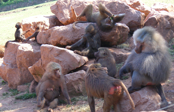
Baboons. Photo by Marie Hale.

Baboons are more like humans than we may like to think. They are as nasty to each other as we are. Photo by Marie Hale.

Victoria Times Colonist, November 2, 2012—Within less than 24 hours on October 9–10, 2012, two 15-year-old girls made newspaper headlines.

Amanda Todd and Malala Yousafzai lived worlds apart, separated by language, history, culture, and geography. Their stories, however, share tragic similarities.

Todd, as we know, committed suicide after being bullied online and at school. Yousafzai was shot in the head and neck by Taliban terrorists, which in my opinion, are nothing more than organized bullies with guns and grenades.

Todd and Yousafzai were targeted for abuse because—according to the narrow strictures of each group of bullies’ codes of conduct—these two young women had crossed moral lines—lines defined and marked and defended by the bullies themselves.

Todd and Yousafzai were targeted because they were women. Todd was fighting to move beyond a painful series of incidents that had started when she was sexually exploited by a cyber-stalker/blackmailer. Yousafzai spoke out for the rights of girls and women to attend school in a country where they had, very recently, been forbidden education.

I’m not saying bullies pick only on girls. Of course not. Bullies single out anyone whom they can get away with picking on. Some choose weaker and more vulnerable targets. Like Amanda, who lacked a supportive peer network that could help her and intervene on her behalf. Like Reena Virk, Dawn-Marie Wesley, Hamed Nastoh, Ashkan Sultani and all other teens—female or male—who have been bullied to death in B.C.

Bullies also prey on those who are strong or successful in some way because of the threat this poses to the bullies’ positions, worldviews or self esteem. Yousefzai, in advocating for women’s education and in blogging about her life under the Taliban for the BBC, fits this category.

We know bullying isn’t unique to humans. Stanford University neuroscientist and stress researcher Robert Sapolsky details his work studying baboons in Kenya’s Serengeti in many of his books. In A Primate’s Memoir, he writes, “Baboons live in big, complex social groups, and the population I went to study lived like kings…. The baboons work maybe four hours a day to feed themselves; hardly anyone is likely to eat them. Basically, baboons have about a half dozen solid hours of sunlight a day to devote to being rotten to each other. Just like our society….”

Typical baboon bullying goes something like this: A troop’s alpha male appropriates a subordinate’s hard-earned lunch of tubers. The subordinate, smarting, slashes the next guy down the pecking order, who bites a female, who smacks a juvenile, who thumps the newest kid on the block….

All within seconds.

Disturbingly like some families, schoolyards and online chatrooms.

And so the hurt in Sapolsky’s baboon troops cascades down and around. Then, one year in the 1980s, animals from one troop feasted on meat they found in the garbage dump behind a nearby tourist lodge. Many of the troop partook of the feast; the most aggressive partook the most.

Alas, the meat was diseased. Many in the troop perished, including all the aggressive males.

Females suddenly outnumbered guys. The males that survived were more interested in grooming and being groomed—in connecting socially with members of the troop—than in terrorizing others. And when aggressive adolescent males wandered in off the savannah to become troop members, they were quickly made to leave bullying behaviors at the door.

A kinder, gentler baboon society was born. According to Sapolsky, that society continues to thrive today, some 25 years later.

Sapolsky’s tale provides hope for us so-called higher primates. Of course, we humans are not permitted to feed tainted meat to or otherwise dispatch bullies, sociopaths, anti-social jerks and others who make our lives miserable. But those in charge and those below and those around and those online can connect and support and stand up for each other. We can each refuse to tolerate language and actions meant to hurt or intimidate, whether directed at us or at others. We can each intervene when hurt happens. We can each say, “No. Not on my watch.”

After all, if baboons can do it, surely we can, too.

Can’t we?

—30—


A version of this article appears in the Victoria Times Colonist