View of the Columbia Icefield from the visitor centre. Photo © Samantha Marx (@smath.com). via creative commons and flickr

When you stand on the new Glacier Skywalk, just off the Icefields Parkway in Jasper National Park, you can look down into the depths of the Sunwapta Valley 280 metres beneath your feet and up at the heights of the Continental Divide around you.

Nestled among these peaks is the Columbia Icefield, a massive complex of ice that first formed more than 10,000 years ago. Six kilometres long, almost a kilometre across, and in some places 300 metres thick, it feeds eight major glaciers and three major river systems.

One of these is the Columbia River. This waterway stretches 2,000 kilometres, from its Rocky Mountain headwaters, through eastern B.C. and four U.S. states. It drains a region the size of France, and now encounters 14 dams along its length, including three in this province.

The river is the subject of an international agreement on shared river management. On September 16, 1964—50 years ago this Tuesday—Canada and the U.S. ratified and implemented the Columbia River Treaty….

Read the rest of this editorial at the Victoria Times Colonist….


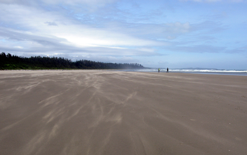
Long Beach, Pacific Rim National Park. Photo © Kyla Duhamel, via creative commons and flickr

Long Beach, Pacific Rim National Park.

Nature Boy uses a number of smartphone apps with his work. Some help him identify birds. Others help him key out wild plants, fungi and other assorted roughage. He opens the astronomy app whenever he’s outside on clear nights. And because he works with people, he often photographs—with permission—families, school groups and kids Doing Cool Stuff Together in Nature, then immediately emails the pictures to the respective parents and teachers.

For somebody who interfaces so intensely with the natural world, he’s pretty hip to the latest gadget, gizmo and gew-gaw. His use of technology to augment his and others’ experience of the outdoors exemplifies some of the more positive, constructive aspects of being constantly connected. ]

Those integrated, positive interfaces came to mind when news broke earlier this year that Parks Canada proposed to provide WIFI access at busy areas of some national parks and historic sites over the next few years.

For example, with park WIFI access, I could double-check the tides before paddling around Gulf Islands National Park Reserve. I could check the day’s weather before setting out on the Long Beach Challenge, the 9.5-kilometre route that Pacific Rim National Park is marketing as the latest, greatest B.C. marathon-fitness trail. I could get Nature Boy to look up that weed while we stomp about Fort Rodd Hill.

Of course, with cell-phone coverage in this region, I could do most of that without park WIFI. At Fort Rodd Hill, I may even receive annoying text messages from the U.S. about cell-phone roaming charges.

However, my reaction to the news about Parks Canada joining the 21st Century may have been atypical….

Read the rest of this editorial at the Victoria Times Colonist….

Water stored in the St. Mary’s Reservoir, north of Cardston, Alberta, insures area farmer’s crops against drought, which is common in that part of the province. In 1998, when the reservoir was drained to build a new spillway, researchers discovered tools used by ancient Albertans, as well as bones and footprints of at least 20 species of long-extinct animals.

“If you had stood there 11,000 years ago, you could have seen mammoths, horses, camel, caribou, bison, wolves, ground squirrels, and birds—maybe all at once,” says Len Hills, professor emeritus of geology and geophysics at the University of Calgary, and one of the scientists studying the site. Joining him in the research are university archaeologist Brian Kooyman and students Paul McNeil and Shayne Tolman, the site’s discoverer. “We know from the way the trackways are intermingled that these animals were right there, together. And man was there, too—he was part of that environment.”

The site is a window on the end of the Ice Age in southern Alberta. By inventorying the animals that lives in the region and studying the role of early humans at the site, Hills and colleagues reconstruct the ancient environment.

About 12,000 years ago, the site was an island delta at the end of a glacier-fed lake. When the St. Mary’s River later drained the lake, it created a massive floodplain west of the island Within a period of days or maybe weeks, large numbers of diverse animals visited the area to feed on the delta’s lush vegetation and drink from the nearby river, trampling the gound with their hooves and feet. Thick layers of sand and dirt blew eastward from the floodplain to bury tracks, bones, and tools. A series of brief geological moments were preserved, recording the presence of animals and humans over a 300-year period about 11,000 years ago.

The oldest tools are Clovis points, flaked-stone implements used by the first North Americans. Not far from where the team was excavating the skeleton of a horse, the researchers found toold that may have been used to kill the animal. Laboratory tests reveal traces of ancient horse protein on two of the Clovis points.

“We’ve known from other sites in North America that they hunted mammoths,” says Hills. “But this is the first sold evidence that Clovis people actually hunted horses. Maybe early humans influenced the extinction of these animals—not just mammoths, but horses, too.”

What precisely caused the disappearance of so many Ice Age mammals 12,000 to 9,000 years ago is uncertain. Climates and environments were changing rapidly as the glacier receded from the continent. Those changes alone would stress animal populations. New species from Asia may have increased competition for food, or may have introduced diseases. Humans may have been another factor in the ecological reorganization.

When McNeil inventoried and analyzed the fossil trackways, comparing information about movement and size of the ancient animals with data from tracks made by modern elephant herds, he found some evidence that the herds visiting the reservoir site 11,000 years ago were stressed.
“The ratio of young animals to adults was far below what we would consider healthy levels in modern populations of similar animals,” he says. “This site captures this one brief moment in time and tells us something was definitely happening.”

The magnitude of the site is the way that it is letting us see how these animals interacted with their environment, with each other, and with early humans.

excerpted from: Reading the Rocks: A Biography of Ancient Alberta

Cycling in Victoria. Photo © John Luton, via creative commons and flickr

With the 2014 Tour de France ending tomorrow, this year’s version delivered the usual combination of surprise and excitement to fans. The spectacular high-speed crashes and cringing injuries that regularly occur during the renowned cycling race brought sudden and unexpected ends to the participation of many contenders for this year’s title. For the likes of former tour champions Alberto Contador, Chris Froome, Andy Schleck and Mark Cavendish, who broke bones and left skin and blood on the roads of France and U.K., the 2014 Tour de France could be considered something of a disaster.

Fortunately, today’s Tour de Disaster, here in Victoria, contains little opportunity for that kind of excitement….

Read the rest of this editorial at the Victoria Times Colonist….

Bury Bach Choir, U.K. Photo © Tim Regan, via creative commons & flickr

Festival season has begun. We’ve seen spot prawns served multiple ways, we drank tea in Oak Bay, we entertained our guests at the Sooke River Bluegrass and Vancouver Island Cultural festivals, the Aboriginal Cultural Festival wraps today, and the Foodie Film Fest has just started making us drool. And, for the next week, Victoria’s International Jazz Festival will be bringing jazz lovers together.

So many of the big events during the summer here and elsewhere include music—as the events’ focus, part of the line-up, or a contrapuntal offering. These events are community occasions. They bring people from across the region together to share an experience.

Music stitches together our social fabric in many ways. Those who enjoy bluegrass or ska or funk or even the Grateful Dead share a common language within their genre. Fans of certain bands form their own insular groups, sometimes following the musicians’ performances, travels and lives online or in person in a way that borders on stalking. And, yes, whenever strangers gather to listen to the same music, they bop their heads to the beat, tap their fingers, and swing their feet to the rhythm, in time, together.

And it turns out, when music plays, we share the experience of melody, harmony and rhythm at a much more basic, personal level….

Read the rest of this editorial at the Victoria Times Colonist….

Amhersham A Cappella Choir, amershamacapella.com. Photo © Margaret (Lady P.P.), via creative commons and flickr

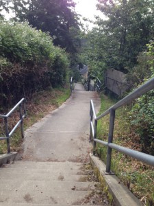
Pathway from Mildred Street to Wilkinson slips between backyards.A little-known network of shortcuts and passageways knits many of the region’s urban areas together.

These connecting pathways—they’re too short to be called trails—pass unobtrusively among municipalities’ houses and yards. They stitch residential streets to other residential streets, quiet parks to formal trail systems, seemingly dead-ends to pedestrian-only exits, and neighbourhoods to crescent beaches or rocky shorelines. They wind through neighbourhoods, linking a person’s travels into lines and loops through local urban geography.

Each of the region’s municipalities treats these access points and rights of way differently. Some, like Saanich, glory in their abundance, and chart their locations like chicken scratchings on trail maps. Some municipalities, like Victoria, make the most of the few no-vehicle passageways that century-old urban planning and decades-old development have left them, and have worked them into formal walking and even lazy-day cycling loops. Some municipalities keep quiet about them, leaving local explorers to scrutinize municipal maps for faint lines and other signs that may—may—indicate the little-used laneways amidst the bolder cartographic connections.

Regardless of whether they’re published or not, most of these passages seem to remain neighbourhood secrets, known primarily to those who live alongside them.

In fact, these rights of passage could be seen as rites of passage….

Read the rest of this editorial at the Victoria Times Colonist….

This slideshow requires JavaScript.

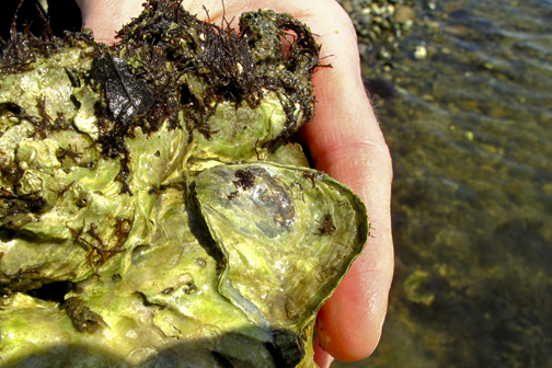
Olympia Oyster. Photo © Deep Bay Marine Field Station, Vancouver Island University, www.viu/deepbay

Beneath the quiet surface of the Gorge Waterway and Portage Inlet, life, death and survival play out in a drama affecting a rare, tasty B.C. marine species.

The Olympia oyster is the only oyster species native to the province. Once abundant from Alaska to Panama, it disappeared from much of its habitat by the early 20th century, a victim of its own tastiness, overfishing, and waters contaminated with sewage, chemicals and sediment that poisoned and suffocated the oyster beds. The fished-out waters included the Gorge Waterway, from which the oyster was considered locally extinct by the 1920s.

The state of Olympia oyster populations in the province remains such that Canada’s Species at Risk Act lists it as a species of special concern.

However, the oyster has surprised everyone. Some years back, researchers found the small, unprepossessing-looking mollusc had returned and set up house in the Gorge.

Read the rest of this editorial at the Victoria Times Colonist….

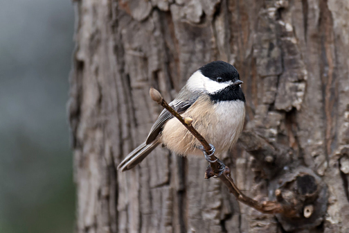
Sure, he's cute, but Vancouver's Bird of the Year? The Black-capped Chickadee. Photo © Russ, via creative commons & flickr

The robin chicks outside my window disappeared last night. At about 4:00 a.m., much rustling of shrubberies and great squawkings by Ma Robin occurred. When I poked my head outside, the three nearly grown babies had vanished.

For three weeks, the daily charting of the chicks’ progress was a household highlight. Their sudden, tragic loss has taken us all aback, bringing forth long faces and even a sniff or two. Last night, they no doubt became breakfast for an intrepid raccoon.

While Ma Robin built her nest, brooded eggs and stuffed bugs into gaping young beaks, our neighbours on the mainland elected Vancouver’s newest winged poster child. More than 700,000 people voted in the five-week-long popularity contest for Official City Bird of 2015. More than one-third of voters backed the Black-capped Chickadee over five other contenders.

Several things about the contest astonish me….

Read the rest of this editorial at the Victoria Times Colonist….